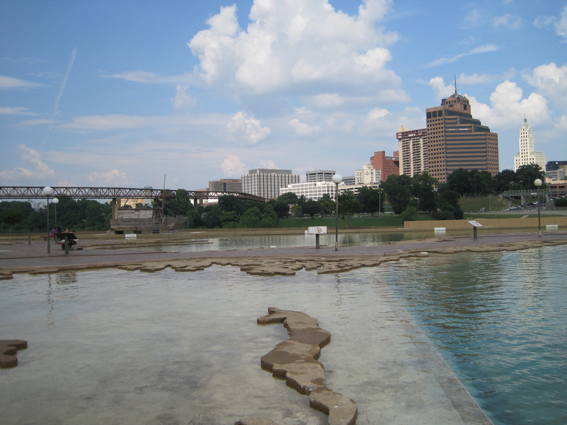
Mud Island River Park is a city park on a narrow island in the Mississippi River, just off the north end of downtown Memphis. It opened in 1982 and was built around a single centrepiece: a large outdoor scale model of the lower Mississippi River, laid out so a visitor can walk its full length, from the river’s junction at Cairo, Illinois, down to the Gulf of Mexico.
Where is Mud Island, and how do you get there?
Mud Island is a landmass formed by sediment in the Mississippi River, separated from downtown Memphis by a channel called the Wolf River Harbor rather than by the main river itself. It sits directly across from the Pyramid, the steel-clad former arena that now houses a Bass Pro Shops store — a landmark covered in more detail in the guide to the Memphis Pyramid.
The park occupies the southern end of the island. The northern end is Harbor Town, a planned residential neighbourhood built from the mid-1980s onward, with its own streets, a marina and housing that is entirely separate from the park itself; the distinction between the two is explained fully in the piece on Harbor Town and Mud Island. Pedestrian and bicycle access to the island runs via a connector bridge near the Pyramid. A monorail once carried visitors across from downtown; local reporting over the past decade has described that service as suspended for extended periods, so anyone planning a visit that depends on it should confirm current access on the operator’s own site rather than assume it is running.
What is the scale model of the river, exactly?
The model is a paved, open-air channel running the length of several city blocks, through which water is pumped continuously so it actually flows downhill, the way the real river does. It follows the Mississippi’s course — its bends, its confluences, the towns strung along its banks — from Cairo, Illinois, where the Ohio River joins the Mississippi, down to a basin at the model’s end that stands in for the Gulf of Mexico.
Walking the model’s length is meant to compress roughly a thousand miles of river into a distance a visitor can cover on foot in a matter of minutes, passing markers for Memphis, Vicksburg, Natchez, Baton Rouge and New Orleans in something close to their true relative position on the river. It is, in effect, a working topographic diagram rather than a diorama — the point is the river’s actual geography, not a themed re-creation of it.

What else is on Mud Island besides the model?
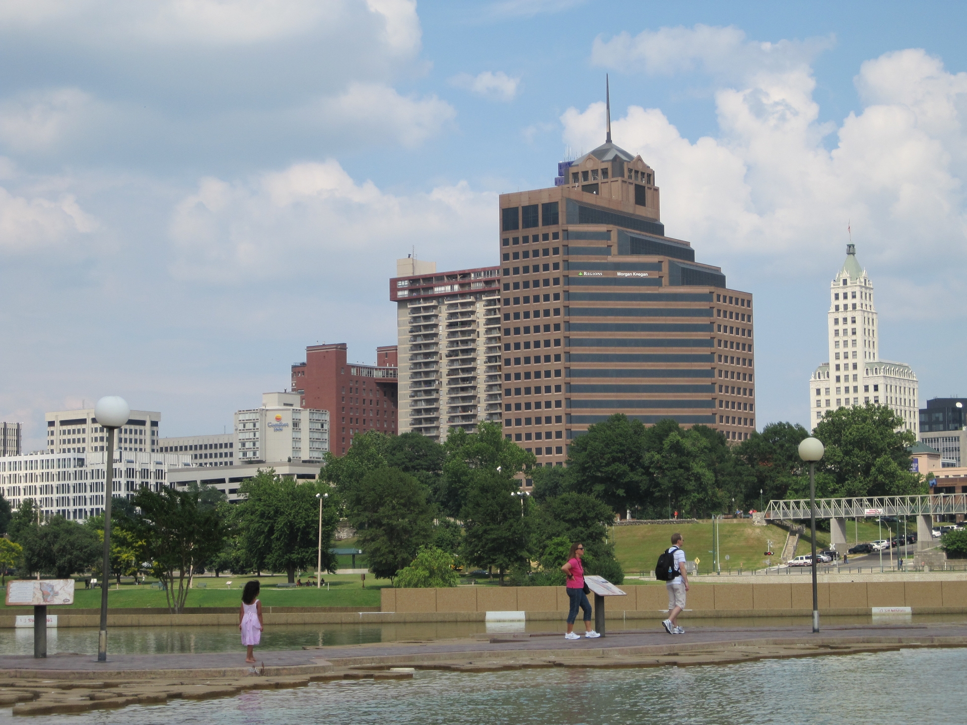
The park also includes river-facing walkways, a promenade with views back across to downtown, and open lawn space along the water. For years the park’s indoor component was the Mississippi River Museum, a set of exhibits on river geology, steamboat travel and the delta’s history. Local media reported the museum’s closure in 2016 amid city budget reductions, and its building’s current use should be checked directly rather than assumed from older write-ups.
The island also had a long association with the Memphis Belle, the B-17 bomber that flew twenty-five combat missions over Europe in the Second World War. It was displayed in a pavilion on Mud Island for close to two decades before moving to the National Museum of the United States Air Force in Ohio; the full history of that move is covered separately in the piece on where the Memphis Belle is now.
Is Mud Island River Park still open to the public?
The land is public parkland, and pedestrian access to the island itself has generally continued even as individual attractions on it have changed. Because opening status, staffing and which parts of the site are actively maintained have shifted over the years — and because that kind of practical detail dates quickly — the operator’s own current information is the source to check before visiting, rather than any fixed set of hours repeated here.
The park has, at various points, fallen under the city of Memphis’s parks division and under riverfront-focused bodies such as the Memphis River Parks Partnership, the organisation that also oversees the redeveloped Tom Lee Park downstream on the downtown riverfront. Its own site is a reasonable place to confirm what on Mud Island is currently accessible.
How does Mud Island fit into a Memphis riverfront visit?
Mud Island is one stop in a much longer riverfront that runs from the cobblestones below the bluff down past Tom Lee Park to the newer stretches south of downtown. The shape of that whole corridor — what connects to what, and on foot versus by bike — is laid out in the guide to the Memphis Riverfront Loop, which situates the island relative to downtown’s other riverfront pieces.
For a resident, Mud Island functions less as a destination in its own right and more as the buffer between downtown and Harbor Town — a park that residents of that neighbourhood pass through on a daily walk or ride, rather than a place most Memphians visit as an event. For a visitor building a downtown day around the river, it sits well alongside other riverfront stops covered in the broader Parks & Riverfront archive, and it pairs naturally with a walk through downtown itself, detailed in the walking route through downtown Memphis.
Do you need a car to get there?
No — the connector bridge from near the Pyramid is built for pedestrians and cyclists, which makes Mud Island one of the more straightforward downtown riverfront sites to reach without driving. Broader guidance on managing a downtown day car-free, including how the bridges, sidewalks and bike infrastructure connect, is covered in the piece on spending a day in Memphis without a car. Cyclists specifically will find the island connects into a wider network discussed in the guide to cycling in Memphis.
For a first-time visitor working out where a stop at Mud Island fits against Beale Street, Sun Studio, Stax and the rest of downtown, the general planning hubs — the Memphis guide and Memphis practical information — are the better starting points than treating the island as a stand-alone destination. It reads best as one deliberately quiet stretch of riverfront in a downtown otherwise built around music, food and civil-rights history, and it is worth treating that way: a short, specific stop rather than a half-day plan.
Access Memphis is an independent guide written from published, checkable sources. We have not visited the places described here and we do not publish personal recommendations or invented ‘local favourites’ — where something is singled out as notable, we say who says so. Opening times, fares, closures and prices change at short notice, so treat everything here as a starting point and confirm with the museum, operator or venue directly before building a day around it. We give no advice on visas, insurance, health or safety; use your own government’s official guidance for those.
Featured image: Photo by Thomas R Machnitzki, source, CC BY-SA 3.0
