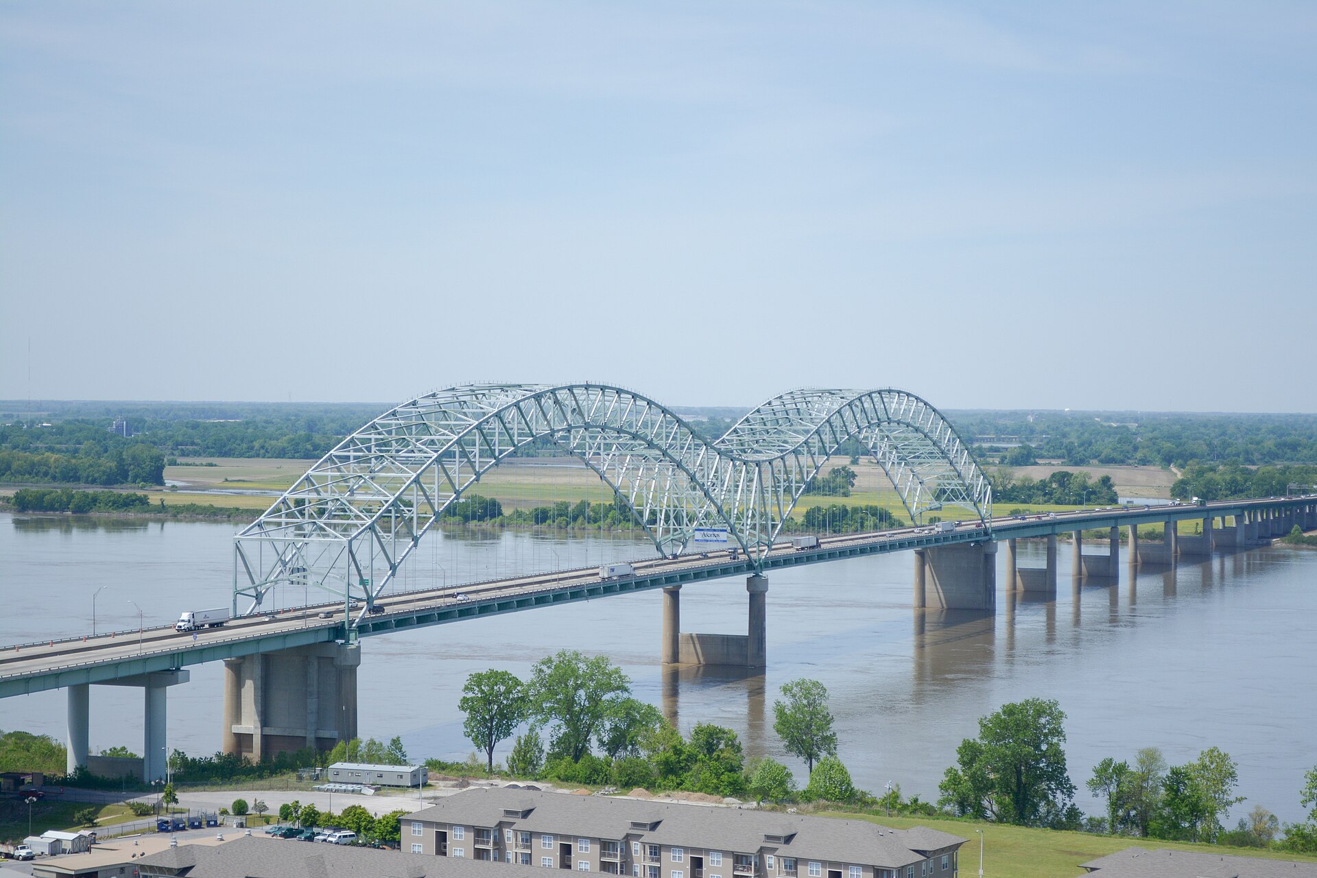
The Hernando de Soto Bridge carries Interstate 40 across the Mississippi River, connecting downtown Memphis, Tennessee, to West Memphis, Arkansas. Locally it is called the “M Bridge” because its two steel tied-arch spans, seen from the side, form the shape of the letter M — a profile that is lit at night and visible along much of the Memphis riverfront.
What is the Hernando de Soto Bridge?
It is a highway bridge, not a monument or a museum piece — a working structure carrying one of the country’s major east-west interstates over the Mississippi River. It opened to traffic in 1973 and is built as a twin steel tied-arch design, meaning each of its two main spans is held up by a steel arch above the roadway rather than a truss below it or cables from a tower.
The bridge sits just north of downtown Memphis, within sight of the bluffs the city is built on, and lands on the Arkansas side at West Memphis. As part of I-40, it is one of only a handful of fixed crossings of the lower Mississippi River, which makes it significant well beyond Memphis: freight moving across the country on I-40 has no practical alternative route for hundreds of miles in either direction.
Why is it called the “M Bridge”?
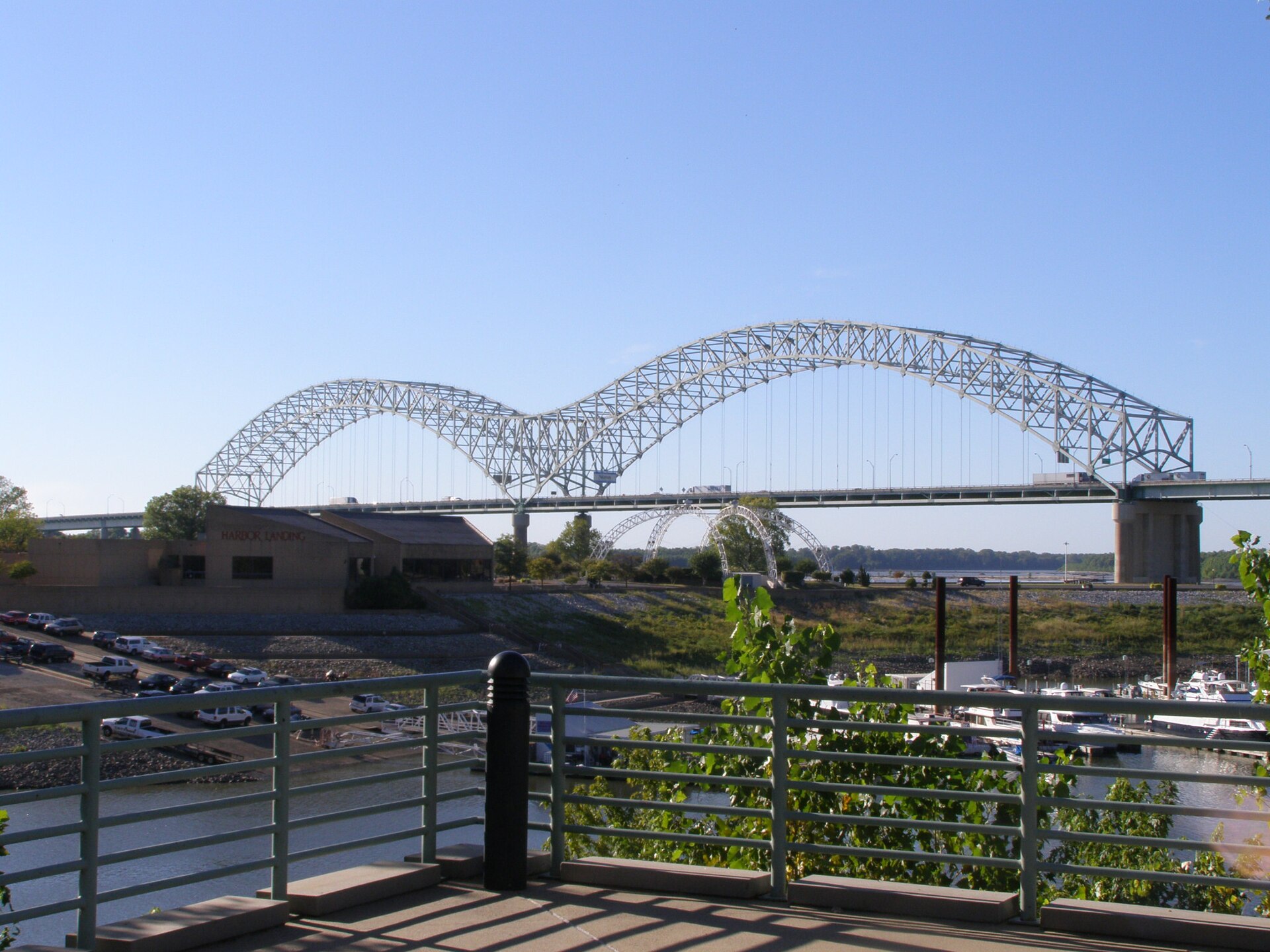
The nickname describes the shape, not any hidden meaning. Each of the bridge’s two arch spans rises and falls in a single curve; set side by side, sharing a central pier, the two arches trace a silhouette that reads as a capital M against the sky. Memphis traffic reporters and residents have used “the M Bridge” for decades as shorthand, partly because it is faster to say than the full name and partly because the shape is genuinely distinctive on the skyline — especially after dark, when the arches are outlined in lights and stand out clearly from the riverfront.
The nickname also does practical work: it distinguishes this crossing from the city’s other Mississippi River bridges, which have their own names and shapes, described below.
Why is the bridge named after Hernando de Soto?
Hernando de Soto was a Spanish explorer whose expedition, moving through the interior Southeast in 1539–1543, is generally credited with being among the first documented European parties to reach the Mississippi River. Historians have long associated that crossing with the general vicinity of present-day Memphis, though the precise site is not settled and the record from the expedition itself is thin. The National Park Service’s De Soto National Memorial, which interprets the expedition’s landing and route, is the fullest official account of who de Soto was and what is and isn’t known about where he traveled.
The bridge’s name, then, commemorates a historical association with the region rather than a documented fact about this exact stretch of river. That distinction is worth keeping in mind: the bridge is named for a claim about early European contact with the Mississippi, not for an event that took place on this specific bank.
How does the bridge fit among Memphis’s other river crossings?
Memphis has several Mississippi River bridges, each with its own history and shape, and the Hernando de Soto Bridge is only the newest of the highway crossings:
- Harahan Bridge — completed in 1916 as a rail and vehicle crossing; its old roadway decks now carry the Big River Crossing pedestrian and cycling path.
- Frisco Bridge — an older rail bridge just north of the Harahan, still in active freight rail use.
- Memphis & Arkansas Bridge — opened in 1949, carrying Interstate 55; a cantilever truss bridge often called the “Old Bridge” by comparison with the de Soto crossing.
- Hernando de Soto Bridge — opened in 1973, carrying Interstate 40; the newest of the group and the only true arch bridge among them.
Together these bridges explain why Memphis grew where it did: the bluffs on the Tennessee side gave the city a defensible, floodproof site to control river and, later, rail and road crossings. Readers working through the city’s landmarks more broadly can find the wider picture in the Memphis guide and the landmarks and sights archive.
_P9120095.jpg)
What happened when the bridge closed in 2021?
In May 2021, the Tennessee Department of Transportation closed the Hernando de Soto Bridge to traffic after a routine inspection found a fracture in a steel beam supporting the structure. The closure was significant enough that it also halted barge traffic on the river beneath the bridge for a period, since the compromised span raised safety concerns for vessels passing underneath.
With I-40 closed, traffic was rerouted onto the older Memphis & Arkansas Bridge on I-55, which absorbed both directions of interstate traffic across the river for months and produced heavy, sustained congestion on both sides of the crossing. The bridge underwent repairs before reopening later that year. Readers wanting the technical detail on cause, timeline and repair should go to TDOT’s own reporting rather than secondhand summaries, since the department is the authority of record on the structure’s condition and any future work.
Where does the bridge fit into the Memphis riverfront?
The Hernando de Soto Bridge is a fixed point on the downtown skyline, visible from much of the riverfront and from vantage points on Mud Island and along the bluff. It sits within view of other downtown landmarks that define that stretch of the river, including the Memphis Pyramid a short distance to the north — covered in detail in what the Memphis Pyramid is and why Bass Pro Shops is inside it — and the Beale Street entertainment district inland from the river, explained in what is actually on Beale Street.
The bridge itself is not a visitor attraction in the way a museum or a historic building is — there is no observation deck, and it is not something to walk across. Its relevance to a visitor is mostly visual: it appears in most riverfront photographs of Memphis and is part of what makes the skyline recognizable, alongside the Pyramid and the bluff itself.
What does the bridge mean for getting around Memphis today?
For residents and anyone driving through the region, the practical fact is simpler than the history: this is the I-40 river crossing, and it carries a large share of both local commuter traffic and long-haul freight moving through the Mid-South. Its condition is a live infrastructure issue, not a settled fact of the landscape — the 2021 closure demonstrated how quickly a problem on this single structure can back up traffic for miles on both sides of the river.
Drivers planning a route through or around Memphis, especially anyone crossing between Tennessee and Arkansas on I-40, should check current conditions through TDOT’s own traffic resources before travel rather than relying on older reporting. General guidance on moving around the city, including how the interstate network ties into downtown, is covered in the Memphis practical hub, and the wider question of how the city functions day to day — including how residents think about the river crossings as part of ordinary commuting — is addressed in Living in Memphis.
Is the bridge open to pedestrians or cyclists?
No. The Hernando de Soto Bridge is an interstate highway structure and does not carry a pedestrian or cycling path. Memphis’s dedicated crossing for walking and cycling over the Mississippi is the Big River Crossing, built on the historic Harahan Bridge’s old roadway decks a short distance to the south — a separate structure with a separate history from the interstate bridge covered here.
Access Memphis is an independent guide written from published, checkable sources. We have not visited the places described here and we do not publish personal recommendations or invented ‘local favourites’ — where something is singled out as notable, we say who says so. Opening times, fares, closures and prices change at short notice, so treat everything here as a starting point and confirm with the museum, operator or venue directly before building a day around it. We give no advice on visas, insurance, health or safety; use your own government’s official guidance for those.
Featured image: Photo by Trevor Birchett, source, CC BY-SA 4.0
