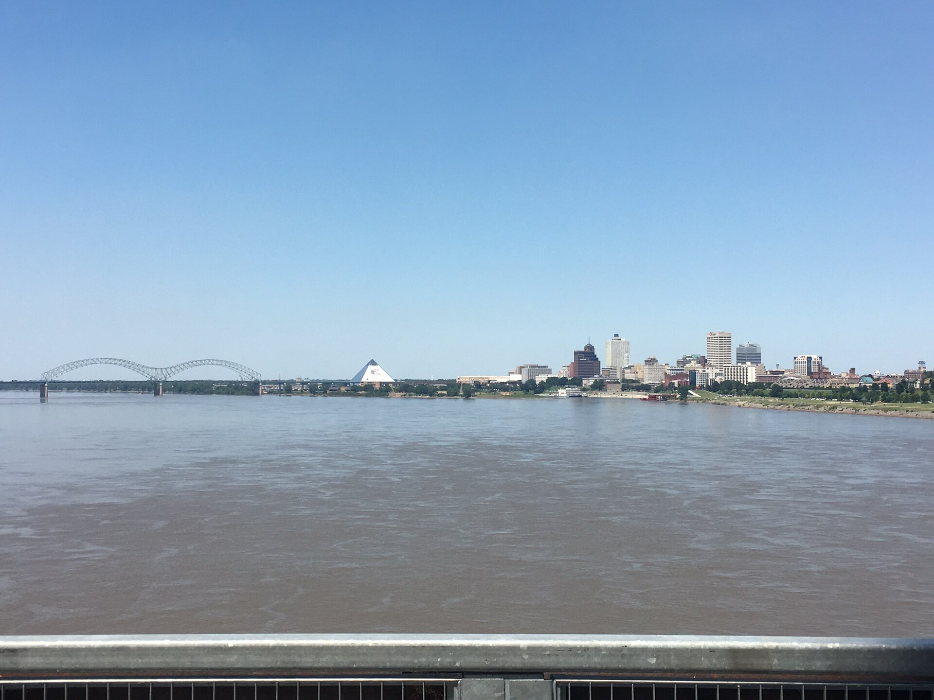
What is the Big River Crossing?
The Big River Crossing is a pedestrian and bicycle path built onto the Harahan Bridge, a steel railroad bridge that has carried trains across the Mississippi River between Memphis, Tennessee, and West Memphis, Arkansas, since 1916. The walkway opened in October 2016, using one of the bridge’s old outer roadways rather than the active rail deck.
What was the Harahan Bridge before it carried pedestrians?
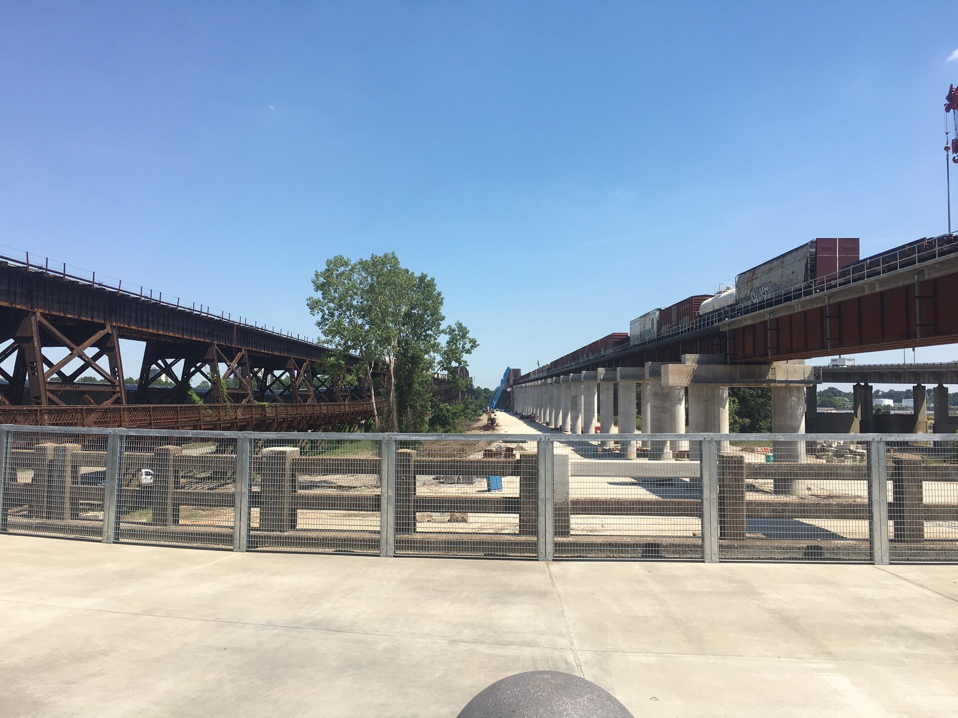
The Harahan Bridge is a cantilever truss bridge completed in 1916 for the Rock Island and Union Pacific railroads, which still own and operate it for freight rail traffic. When it was built, the bridge also carried two wooden roadways cantilevered off its sides for automobile and wagon traffic, since no highway bridge existed at Memphis at the time. Those original roadways burned in a 1928 fire and were rebuilt, then eventually closed to motor vehicles once the Memphis & Arkansas Bridge (now the route of Interstate 55) opened in 1949, giving cars a dedicated crossing instead.
One of those long-unused roadway decks sat empty for decades before it was reengineered as the Big River Crossing footpath. The bridge itself remains an active Union Pacific rail line, and the pedestrian path is physically separated from the tracks by steel and mesh barriers.
How does the walking and cycling path work?
The Big River Crossing runs along the south side of the Harahan Bridge, a fenced, roughly ten-foot-wide deck raised well above the river, connecting the Memphis riverbank to the Arkansas riverbank. The path is lit at night with LED fixtures that can display changing colors, a feature the City of Memphis and project partners have used for civic occasions and observances.
The crossing is described by the Main Street to Main Street project — the public initiative that built it — as the longest public pedestrian bridge over the Mississippi River. That is a claim made by the project itself and by the operator’s own materials, not an independently ranked title, but it is the basis on which the crossing is generally described in local and state tourism references.

Where does it start and end, and what connects to it?
On the Memphis side, the path meets the riverfront near Downtown, close to the area around the Memphis Pyramid and the Mississippi riverbank trails. On the Arkansas side, it descends into West Memphis near that city’s Broadway corridor. The two endpoints were built specifically to link the historic downtowns of both cities, which is where the project’s “Main Street to Main Street” name comes from.
The Memphis approach connects to the city’s riverfront path network and, further inland, to on-street bike routes that reach Downtown and the Medical District. Readers comparing it to the region’s vehicle crossing should note it sits just south of the Hernando de Soto Bridge, the cable-stayed span carrying Interstate 40 — covered separately as the “M Bridge” — which is for motor traffic only and has no pedestrian access.
Is the Big River Crossing free, and when is it open?
The path is free to use and open to walkers and cyclists as a public route rather than a ticketed attraction. Operating hours and any seasonal or maintenance closures are set by the Main Street to Main Street partnership and the City of Memphis, and both can change, so readers should confirm current access on the project’s own site before planning a crossing, especially outside daylight hours.
What is the “Main Street to Main Street” project?
Main Street to Main Street is the name of the public infrastructure project that converted the old Harahan roadway into the Big River Crossing and built connecting bikeways on both riverbanks. It was funded through a federal TIGER (Transportation Investment Generating Economic Recovery) grant administered by the U.S. Department of Transportation, combined with funding from the City of Memphis, the City of West Memphis, and Union Pacific Railroad, which owns the bridge structure and permitted the reuse of the deck. The project’s stated goal, per its own materials, was to give both downtowns a car-free link across the river for the first time.
How does it fit into the region’s cycling and walking network?
The Big River Crossing is positioned as a segment of the Mississippi River Trail, a designated long-distance cycling route that runs along the river from its headwaters to the Gulf of Mexico. On the Memphis side, it links to riverfront paths and Downtown bike infrastructure; on the Arkansas side, it ties into West Memphis’s own trail and street network. For a city where the river itself has historically been a barrier rather than a route, the crossing is notable mainly for what it is structurally: a repurposed 1916 rail bridge deck rather than new construction, sitting alongside continuing freight rail traffic on the same span.
Why does the bridge matter to Memphis specifically?
Memphis grew where it did because the Mississippi bluff offered one of the few stable, high banks for a river crossing and port in the region — a geography explored more broadly in Access Memphis’s guide to the city’s landmarks and neighbourhoods. The Harahan Bridge was part of the first generation of fixed crossings that connected that bluff to the Arkansas Delta on the opposite bank, and the Big River Crossing gives that same 1916 structure a public, non-vehicular function a century later.
Its Memphis-side approach sits near other Downtown riverfront landmarks, including the Memphis Pyramid, explained separately as the former sports arena now occupied by Bass Pro Shops. Readers assembling a Downtown riverfront visit around the bridge can find general planning detail in Access Memphis’s practical hub on getting around and the riverfront, and a wider survey of the city’s protected sites in the Landmarks & Sights archive.
Does the Big River Crossing matter to residents, not just visitors?
For people living in Memphis or West Memphis, the crossing functions less as a sight and more as usable infrastructure: a car-free route between two downtowns, used for running, cycling commutes, and organized charity walks and rides that cross the state line on foot. Its exposure over open water also means conditions shift with the season — river-level wind and summer heat are practical factors the operator’s own guidance addresses more directly than a general travel description can. Broader patterns of how the city functions day to day, including its transport options and seasonal rhythms, are covered in Access Memphis’s hub on living in Memphis.
Because the bridge remains an active freight corridor for Union Pacific, any changes to the pedestrian path — closures for rail maintenance, lighting changes, or trail rerouting — are announced by the bridge’s operators and the Main Street to Main Street project rather than by any single tourism body, which is the appropriate place to check before a visit.
Access Memphis is an independent guide written from published, checkable sources. We have not visited the places described here and we do not publish personal recommendations or invented ‘local favourites’ — where something is singled out as notable, we say who says so. Opening times, fares, closures and prices change at short notice, so treat everything here as a starting point and confirm with the museum, operator or venue directly before building a day around it. We give no advice on visas, insurance, health or safety; use your own government’s official guidance for those.
Featured image: Photo by Dclemens1971, source, CC BY 4.0
