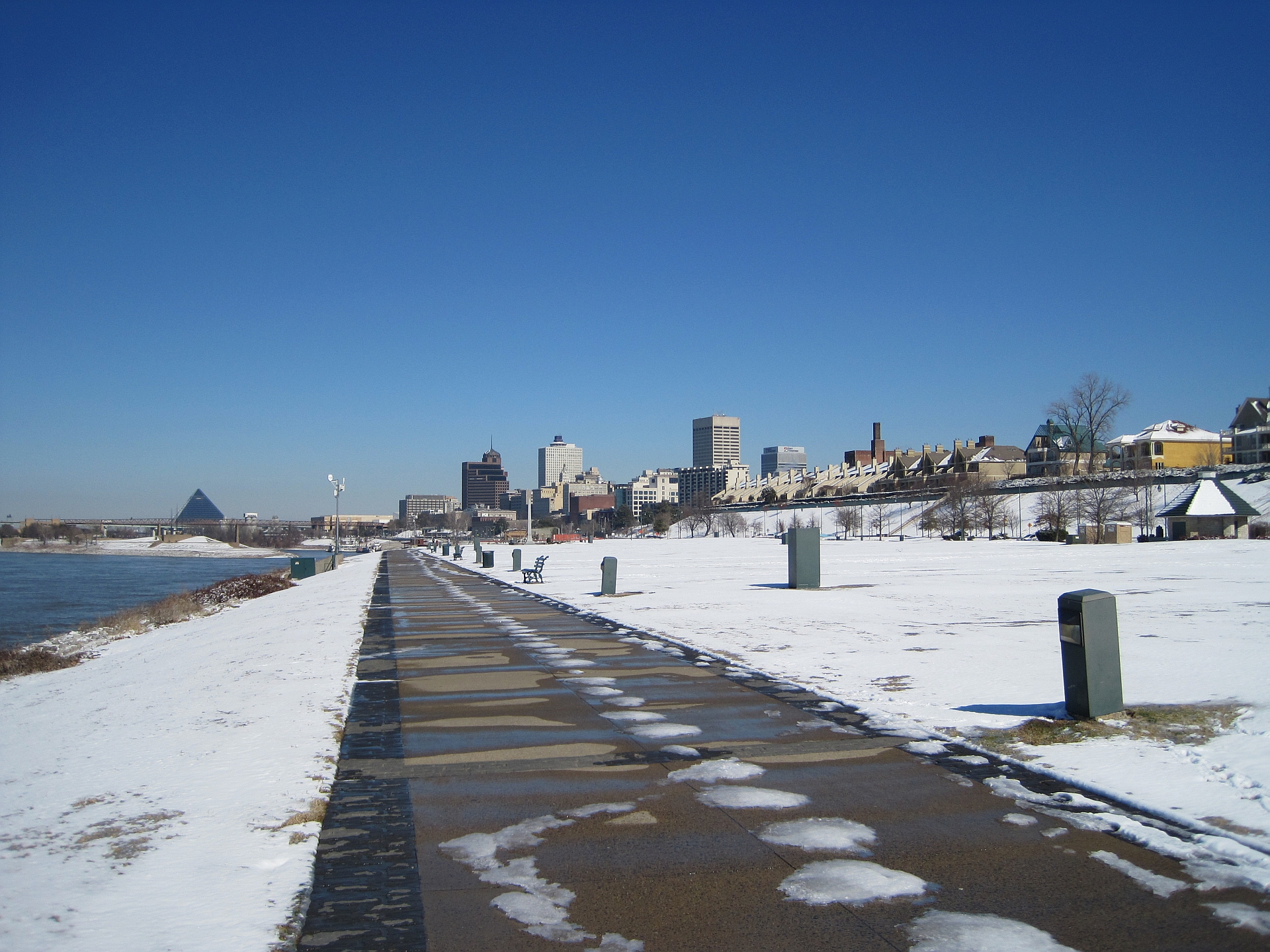
Tom Lee Park is a mile-long public park running along the Mississippi River in downtown Memphis, between the Memphis-Arkansas Bridge and the area near Beale Street Landing. In 2023, it reopened after a multi-year redesign that replaced a mostly flat, tree-sparse lawn with a landscaped park built around the site’s seasonal flooding, led by the Memphis River Parks Partnership.
Where is Tom Lee Park, and what is it for?
The park sits on the batture — the strip of land between the river’s edge and the flood wall that runs beneath Riverside Drive — on the downtown bluff. It faces the river directly, with the Hernando de Soto Bridge and Memphis-Arkansas Bridge both visible from within it, and it connects on foot to the rest of the downtown riverfront, including Beale Street Landing and, further north, Mud Island River Park.
For decades the park’s main civic function was as festival ground. Memphis River Parks Partnership’s own site describes it as the historic home of large parts of the Memphis in May International Festival, including the Beale Street Music Festival and the World Championship Barbecue Cooking Contest, both of which used the open lawn for stages and cooking teams before relocating to Liberty Park starting in 2022, in part because of the park’s construction schedule. Readers planning around either event should check what the Memphis in May festival covers and when it runs, since dates and venues shift year to year.
Who was Tom Lee, and why does the park carry his name?
The park is named for Tom Lee, an African American river worker who, in 1925, rescued 32 passengers from the sinking steamboat M.E. Norman on the Mississippi River near Memphis, using his own small boat, despite being unable to swim himself. The event and its aftermath are recorded by the Tennessee Historical Commission, which maintains a historical marker connected to Lee, and a monument to him stands within the park.
Lee’s story sits alongside other river and civic history that the downtown waterfront carries. A short walk north, Martyrs’ Park memorializes Memphis’s 1878 yellow fever epidemic, another piece of the riverfront’s public memory that predates any festival use of the ground.
What did the park look like before the redesign?
Before 2023, Tom Lee Park was largely an open, mowed lawn with limited shade, a paved path along its river edge, and infrastructure built to host large festival crowds and equipment rather than year-round public use. Memphis River Parks Partnership has described the pre-redesign park as underused outside of festival season, with little to draw residents or visitors on an ordinary weekday.
What changed in 2023?
The park reopened in September 2023 after a redesign led by the architecture firm Studio Gang with landscape architects SCAPE, selected through an international design competition run by Memphis River Parks Partnership. The organization’s own materials describe the project as reorganizing the mile-long site into a series of distinct zones — including shaded gathering structures, an event lawn still capable of hosting large festivals, a children’s play area, and restored batture plantings meant to work with, rather than against, the river’s seasonal rise and fall.
Memphis River Parks Partnership is the organization to check for current, exact figures on the project’s cost and construction timeline, since public reporting on large capital projects like this changes as final accounts are settled; the organization’s own site is the source to confirm any specific dollar figure before repeating it.

Why redesign a park around flooding?
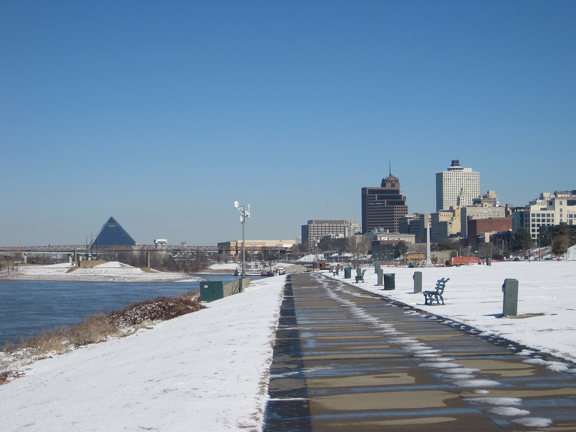
The batture land under Tom Lee Park floods in most years, sometimes for extended stretches, because it sits below the flood wall that protects downtown from the Mississippi’s high water. Memphis River Parks Partnership has stated that the redesign was built specifically to accommodate that cycle — using plant species and grading that tolerate submersion, rather than fighting it with structures that would need constant repair. That framing matters for anyone trying to understand the park’s design choices: features that look sparse or newly planted in early years are meant to establish over time in ground that is, by design, sometimes underwater.
This is the same broader condition that shapes the rest of the Memphis riverfront. Readers curious about how the river’s level affects the waterfront more generally, including whether the water itself is usable, can see what is and isn’t advisable regarding swimming or boating in the Mississippi at Memphis.
How does Tom Lee Park fit into the wider riverfront plan?
Tom Lee Park’s redesign was one piece of a larger set of riverfront changes overseen by Memphis River Parks Partnership, the nonprofit that manages much of the city’s riverfront on behalf of the city of Memphis. The organization’s long-range planning document, generally referred to as the riverfront concept plan, covers changes to Mud Island, the cobblestone landing, and other stretches of the riverfront beyond the park itself. A fuller account of that plan, including what’s proposed and what’s already built, is covered in what the Riverline is and what’s planned for the Memphis riverfront.
The park also connects into a longer stretch of riverfront geography worth understanding as a whole rather than one site at a time — from the bridges to the landing to the parks further north. A guide to what actually lives along the Memphis riverfront lays out that geography in sequence.
What does the park offer a visitor now?
For a visitor, Tom Lee Park functions as an open-air stop on a downtown walk — a place to see the river and both bridges up close, read the Tom Lee monument, and rest in shaded areas built into the 2023 redesign, without an admission fee or set hours beyond general park use. It is not a festival site year-round; large events still concentrate around Memphis in May and other scheduled dates, which readers should confirm through the relevant event’s own site rather than assume.
Because it sits on the standard downtown riverfront walking route, the park is often folded into broader downtown itineraries rather than visited on its own. A walking route through downtown Memphis covers how it connects to Beale Street and the rest of the core.
What does it mean for people who live in Memphis?
For residents, the more significant change may be less about the park’s look than its intended year-round use. Memphis River Parks Partnership has framed the redesign explicitly around daily use — shade, seating, and play space meant to draw people on an ordinary Tuesday, not just during festival week. Whether that holds up as the plantings mature and the park settles into regular patterns of maintenance and flooding is the kind of thing best judged over several seasons rather than at reopening.
The park’s redesign is also one data point in a broader pattern that residents and longtime observers of the city discuss more generally — public investment concentrated downtown while other neighborhoods see less of it. That debate is addressed directly in what people mean when they say Memphis is changing, which is a useful companion piece for readers trying to place a single riverfront project within the larger picture of the city.
Where does Tom Lee Park sit among Memphis’s other riverfront parks?
Tom Lee Park is one of several distinct pieces of riverfront parkland downtown, each with a different function. Mud Island River Park, reached by monorail or footbridge, holds a large-scale outdoor model of the Mississippi River’s course; Martyrs’ Park sits closer to the bridge and centers on the yellow fever epidemic; Tom Lee Park is the largest open green space and the one built to absorb crowds. Readers comparing the three can start with what Mud Island River Park is and what its river model shows, and with the broader Parks & Riverfront category for how Memphis’s riverfront parks relate to one another as a system rather than isolated stops.
What should a reader confirm before visiting?
Opening hours for individual park features, any current construction on adjoining sections of riverfront, and dates for festivals historically associated with the park are all the kind of detail that changes month to month. Memphis River Parks Partnership’s own website is the primary source for current park conditions, and Memphis in May’s own site is the source for festival scheduling and venue confirmation, since both have moved in recent years and are likely to be checked and corrected there faster than anywhere else.
Access Memphis is an independent guide written from published, checkable sources. We have not visited the places described here and we do not publish personal recommendations or invented ‘local favourites’ — where something is singled out as notable, we say who says so. Opening times, fares, closures and prices change at short notice, so treat everything here as a starting point and confirm with the museum, operator or venue directly before building a day around it. We give no advice on visas, insurance, health or safety; use your own government’s official guidance for those.
Featured image: Photo by Thomas R Machnitzki, source, CC BY 3.0
