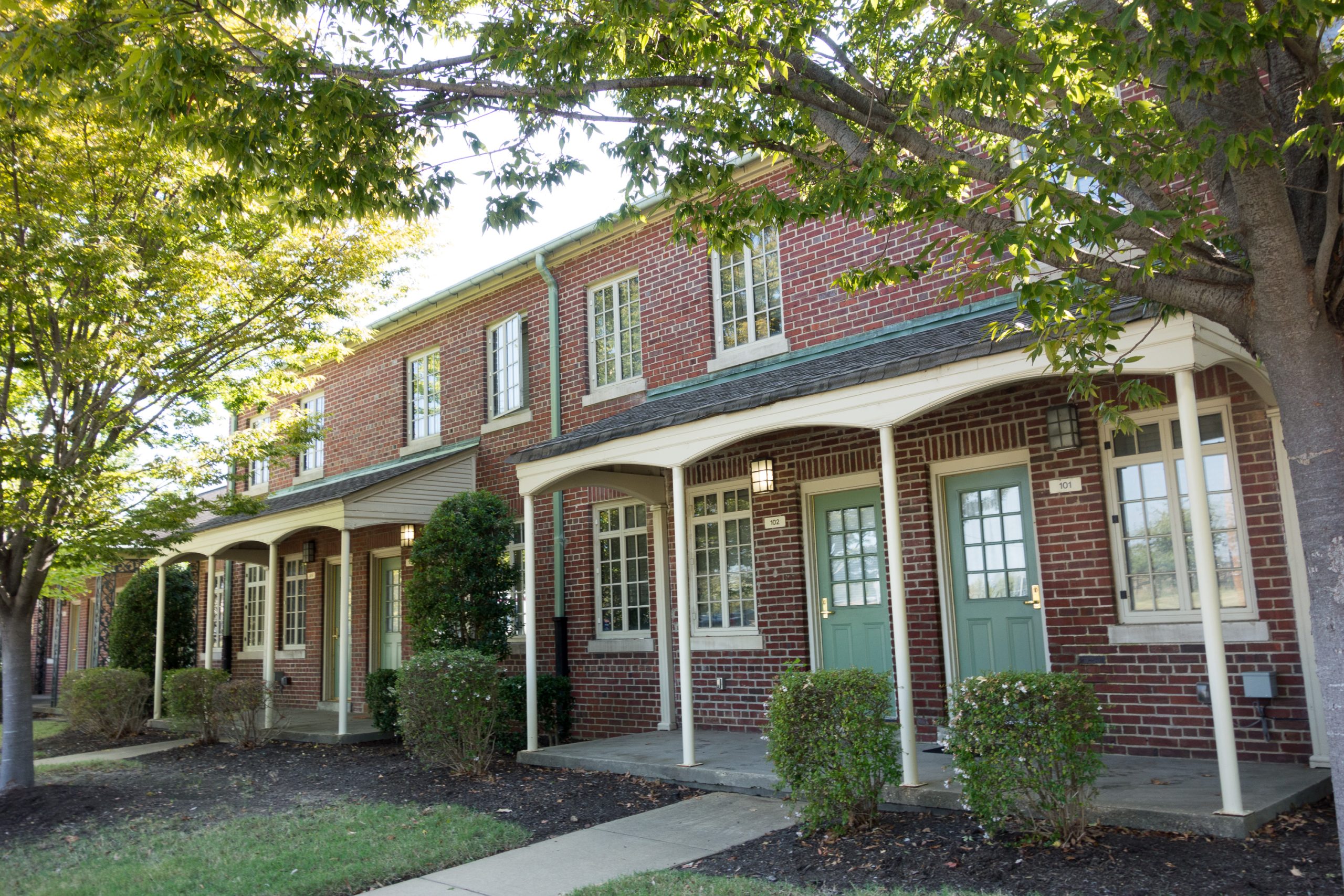
Uptown Memphis is a neighborhood immediately north of downtown, built largely since the early 2000s on and around the site of the demolished Hurt Village public housing project. It is anchored by St. Jude Children’s Research Hospital and functions today as a planned, mixed-income residential district rather than a historic or commercial one.
Where is Uptown Memphis, and what are its boundaries?
Uptown sits directly north of the downtown core, roughly between the Pinch District and Victorian Village to the south and the Wolf River Harbor and Interstate 40 to the north, with Danny Thomas Boulevard forming much of its eastern edge. The Mississippi River bluff runs along its western side.
The name is a modern one, applied to the area as part of its redevelopment rather than inherited from an older place-name. Older Memphis maps and residents would have known parts of this ground as Hurt Village or as the edge of the New Chicago neighborhood further north. For how downtown itself is defined and where its own boundaries run, see what counts as Downtown Memphis and where its boundaries are.
What was there before Uptown existed?
The area was the site of Hurt Village, a public housing complex built in 1954 by the Memphis Housing Authority. By the 1990s, Hurt Village and the surrounding blocks were characterized in federal and local housing reports as an area of concentrated, deep poverty and physical decline, one of several large mid-century public housing projects in American cities identified for demolition and redevelopment rather than repair.
Hurt Village was demolished in phases in the early 2000s. Its removal, and what replaced it, is the single fact that explains almost everything about Uptown as it exists now.
How did Uptown Memphis come to be redeveloped?
The redevelopment was funded through HOPE VI, a U.S. Department of Housing and Urban Development program created in the 1990s to replace distressed public housing with mixed-income communities. The Memphis Housing Authority received a HOPE VI grant for the Hurt Village site, and the resulting neighborhood was rebranded Uptown as part of that federal and local planning process.
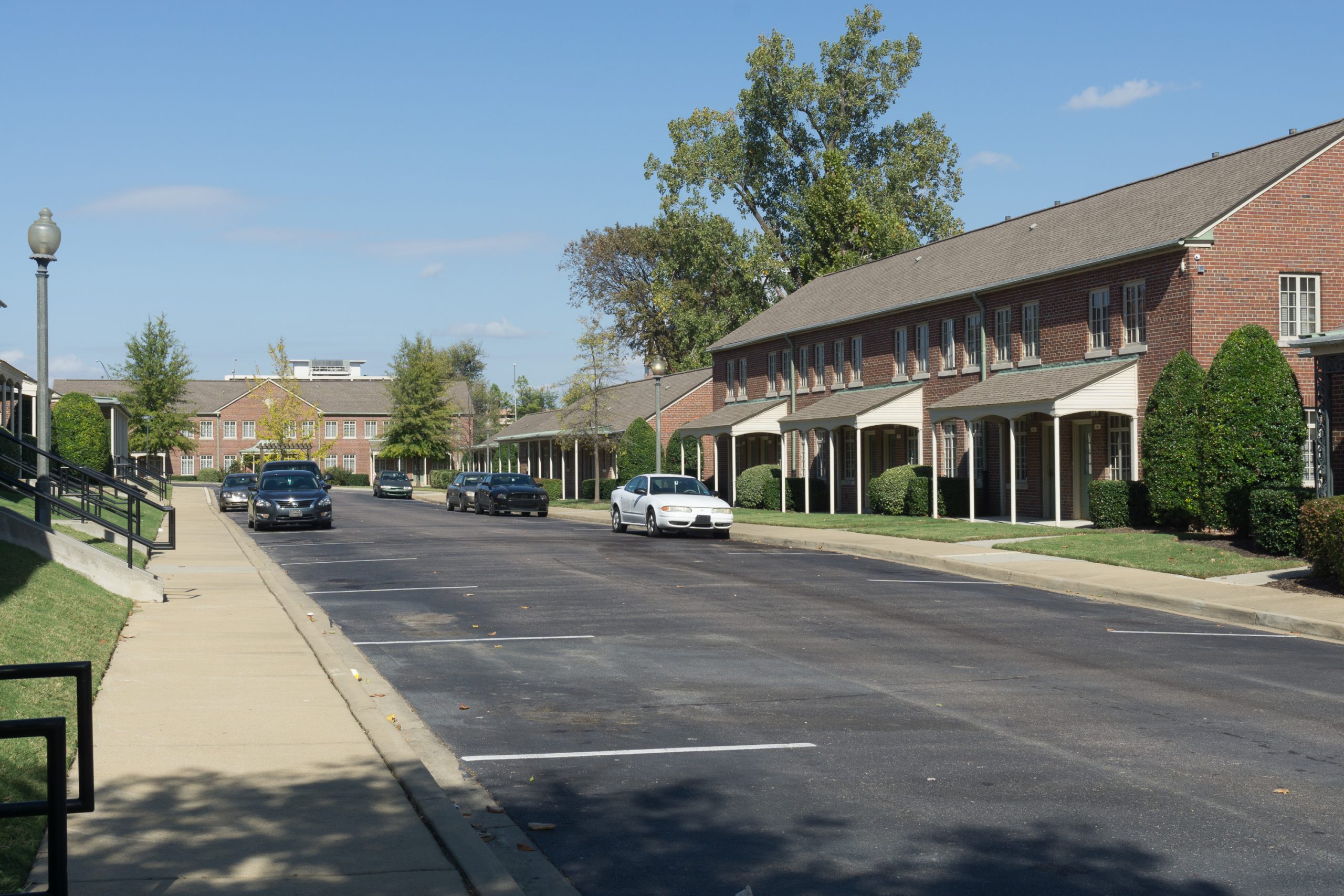
The design followed the New Urbanist model common to HOPE VI projects nationally: a grid of townhouses and low-rise apartment buildings mixing public housing, tax-credit, and market-rate units, built to resemble a conventional residential street rather than a housing project. Uptown Square and Legends Park are the names attached to sections of this rebuilt housing stock. The city and the Memphis Housing Authority describe the goal explicitly as de-concentrating poverty by mixing income levels within the same blocks, a stated policy aim rather than an incidental result.
What is in Uptown Memphis today?
The dominant institution in and immediately adjacent to Uptown is St. Jude Children’s Research Hospital, founded in 1962 and now a large, continuously expanding medical and research campus that anchors the neighborhood’s southern and eastern edges. St. Jude’s own site is the authoritative source for its current campus footprint and ongoing construction, which has reshaped several Uptown blocks over the past two decades.
Beyond the hospital campus, Uptown is largely residential: the HOPE VI townhouses and apartment blocks, newer infill housing, and a scattering of neighborhood-serving retail. It has none of the historic house-museum stock of neighboring Victorian Village, and none of the warehouse-conversion character of the Pinch District immediately to its south — those are covered separately in the guide to Victorian Village’s historic mansions and their history.
How does Uptown relate to Downtown and the Pinch District?
Uptown, Victorian Village, and the Pinch District sit in a north-south line just off the top edge of downtown proper, and the boundaries between them are administrative and historical rather than physically obvious to a visitor walking through. The Pinch District is Memphis’s oldest commercial district north of downtown, tied historically to the city’s 19th-century immigrant and market trade; Victorian Village preserves a run of large 19th-century houses; Uptown is the newest of the three, defined entirely by its 21st-century housing redevelopment.
Because Uptown borders downtown so directly, it is sometimes folded into broader “downtown” descriptions in city planning documents and real-estate listings, even though the City of Memphis and the Memphis Housing Authority treat it as its own defined redevelopment area. Readers working out how Memphis’s central neighborhoods fit together can start from the wider guide to Memphis museums, landmarks, and neighborhoods, which lays out how these adjoining districts relate.
What is it like to live in Uptown Memphis?
For residents, Uptown functions mainly as affordable, centrally located housing within walking distance of downtown employment and directly adjacent to one of the city’s largest employers, St. Jude. The mixed-income model means market-rate, tax-credit, and public-housing units sit within the same blocks, which is a deliberate feature of the HOPE VI design rather than a side effect. Housing researchers and HUD’s own program evaluations of HOPE VI nationally have noted that de-concentrating poverty this way does not automatically resolve the underlying economic conditions of the original residents, many of whom did not return to the rebuilt neighborhood — a documented tension in HOPE VI projects across the country, not one specific to Memphis. Readers researching Memphis’s neighborhoods more broadly, including how poverty and housing are tracked citywide, will find that covered in the guide to living in Memphis.
Because it is a newer, low-rise residential district rather than a commercial strip, Uptown has little independent nightlife or retail draw of its own; residents rely on downtown, the Pinch District, and Midtown for most services, dining, and entertainment.
How do you get to and around Uptown Memphis?
Uptown is walkable to and from downtown along Danny Thomas Boulevard and adjoining streets, and it sits within a short drive of Interstate 40’s downtown interchanges. It is not served by the Main Street Trolley line, which runs through downtown proper rather than north into Uptown; public transit access is by Memphis Area Transit Authority bus routes, and MATA’s own site should be checked for current routes and schedules.
For travelers arriving by train or planning connections from the city’s Amtrak and former rail hub, Central Station and what runs from it sits at the opposite, southern edge of downtown, a useful reference point for orienting Uptown relative to the rest of the central city. General guidance on getting around Memphis without a car, including MATA’s fare structure, is covered in the Getting Around archive.
Is Uptown Memphis worth knowing about as a visitor?
Uptown has no museums, historic markers, or attractions of the kind covered elsewhere on this site, and it is not a destination in the way Beale Street or the South Main Arts District are. Its relevance to a visitor is mostly geographic: it is the ground between downtown and the hospital campus that many Memphis visitors pass through, or drive along, without necessarily registering it as a distinct neighborhood.
For visitors and residents wanting a fuller picture of how Memphis’s central neighborhoods differ from one another — which ones hold the historic architecture, which hold the museums, and which are primarily residential — the Neighbourhoods archive lays out each district on its own terms.
Access Memphis is an independent guide written from published, checkable sources. We have not visited the places described here and we do not publish personal recommendations or invented ‘local favourites’ — where something is singled out as notable, we say who says so. Opening times, fares, closures and prices change at short notice, so treat everything here as a starting point and confirm with the museum, operator or venue directly before building a day around it. We give no advice on visas, insurance, health or safety; use your own government’s official guidance for those.
Featured image: Photo by Kenneth C. Zirkel, source, BY-SA