Mud Island is a landform in the Mississippi River just north of Downtown Memphis, separated from the main riverbank by a narrow channel called the Wolf River Harbor. Harbor Town is the planned residential and mixed-use neighborhood built on the northern part of that same landform, starting in the late 1980s. One is a piece of geography; the other is a development sitting on it.
What is Mud Island, exactly?
Mud Island is a roughly four-mile-long strip of land running along the Memphis riverfront, formed over the 20th century as sediment built up behind a system of dikes and revetments built to manage the river’s channel. It sits between the Mississippi River’s main channel to the west and the Wolf River Harbor — the old channel of the Wolf River — to the east, which is what separates it from Downtown.
Despite the name, it functions today as a peninsula rather than a true island: the land connects to the mainland at its northern end. Locally, though, “Mud Island” has stuck as the name for the whole strip, and it is used both for the landform and, loosely, for the park and neighborhood built on it.
Is Mud Island actually an island?
Not anymore, in the strict sense. Historical accounts of the river’s engineering describe it as having formed from sediment deposits behind revetment work on the Memphis harbor in the early-to-mid 20th century, gradually building into dry, buildable land rather than remaining a mid-river sandbar. The name predates the land bridge and has simply outlasted the geography that first earned it.
What is Harbor Town?
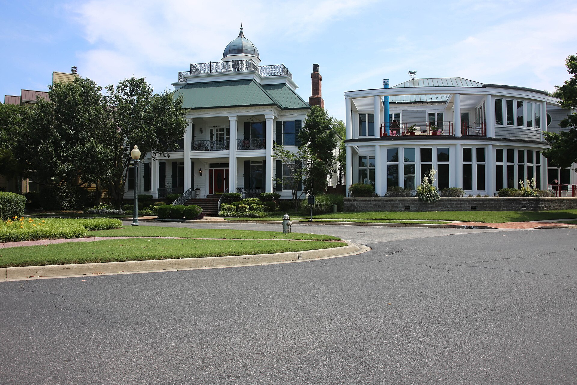
Harbor Town is the planned neighborhood occupying the northern section of Mud Island, developed beginning in 1987 by the Henry Turley Company. It is frequently cited in American urban-planning writing as one of the earlier large-scale New Urbanist developments in the country — built on a walkable grid, with front porches facing the street, a mix of housing types from rowhouses to apartments, a marina, and small-scale commercial space along its main street, rather than the cul-de-sac layout typical of suburban development from the same period.
The neighborhood is entirely residential in character but was designed with day-to-day services within walking distance, in line with New Urbanist planning principles: the idea that a neighborhood should function without requiring a car for every errand. It has its own school and church buildings woven into the street grid rather than set apart in a campus.
Geographically, Harbor Town looks two directions at once — the Mississippi River’s main channel on its west side and the Wolf River Harbor, with the Downtown skyline across it, on the east. That double waterfront is central to how the development was laid out and is often the first thing noted about it in coverage of the neighborhood.
.jpg)
What is Mud Island River Park?
South of Harbor Town, the rest of the peninsula is Mud Island River Park, a city-owned park rather than a residential district. Its best-known feature is a scale-model walk of the lower Mississippi River — a long outdoor watercourse tracing the river’s path and major tributaries from Cairo, Illinois, down to the Gulf, built at a scale visitors can walk alongside. The park has also, at various points, included the Mississippi River Museum, an outdoor amphitheater used for concerts, and a marina.
Programming and operating status at the park have changed over the years — the museum component in particular has had periods of closure — so the City of Memphis, which owns and manages the park, is the source to check for what is currently open and what it costs before planning around it.
How do you get to Mud Island and Harbor Town?
Mud Island is reached from Downtown by a road causeway at its northern end, which is how residents of Harbor Town drive in and out, and historically also by a pedestrian monorail tram crossing the Wolf River Harbor from a station near the Pinch District, close to the Memphis Pyramid. The monorail was built to carry visitors to the river park rather than to serve daily commuting, and its operating schedule is set by the city, so it is worth confirming current hours directly rather than assuming a departure time.
From the river park’s walking paths and the Wolf River Harbor side of Harbor Town, the Downtown skyline and the Hernando de Soto Bridge, known locally as the M Bridge for its shape, are both visible across the water — one of the more commonly photographed sightlines of the Memphis riverfront.
Is Harbor Town a good place to live?
For residents, Harbor Town functions differently from most Memphis neighborhoods precisely because of its New Urbanist design: narrower streets, on-street parking, small lots, and a main street built for foot traffic rather than drive-up retail. That makes it comparatively dense and walkable by Memphis standards, though it is also physically separated from the rest of the city by water, meaning every trip off the peninsula runs through a single causeway connection.
Its river-facing position on two sides gives it a flood-plain relationship with the Mississippi that other Memphis neighborhoods built on the bluff itself do not share, which has shaped both the engineering behind the site and how residents talk about it during high water. Anyone researching the area as a place to live, rather than to visit, should weigh that alongside the walkability the design is usually praised for.
How does Harbor Town fit with the rest of Memphis’s neighborhoods?
Harbor Town is unusual among Memphis districts in being a single, planned development rather than a neighborhood that grew organically over decades, which is the pattern behind places like Midtown or Cooper-Young. Its closest comparison in the city is arguably its proximity, and visual relationship, to Downtown itself rather than any shared history with other residential districts.
Readers comparing it against the rest of the city’s neighborhoods can find the fuller set in the neighbourhoods archive, and the broader landmarks around the Downtown riverfront — including the Pyramid, Tom Lee Park, and the bridges — are covered in the site’s landmarks and sights archive. For planning a visit to the riverfront generally, including how the different crossings and river-facing parks connect, the getting-around and riverfront planning hub is the place to start, and for how Memphis neighborhoods function day to day, the living in Memphis hub covers that ground in more depth. A wider survey of the city’s museums, landmarks, and districts is in the Memphis guide hub.
Access Memphis is an independent guide written from published, checkable sources. We have not visited the places described here and we do not publish personal recommendations or invented ‘local favourites’ — where something is singled out as notable, we say who says so. Opening times, fares, closures and prices change at short notice, so treat everything here as a starting point and confirm with the museum, operator or venue directly before building a day around it. We give no advice on visas, insurance, health or safety; use your own government’s official guidance for those.