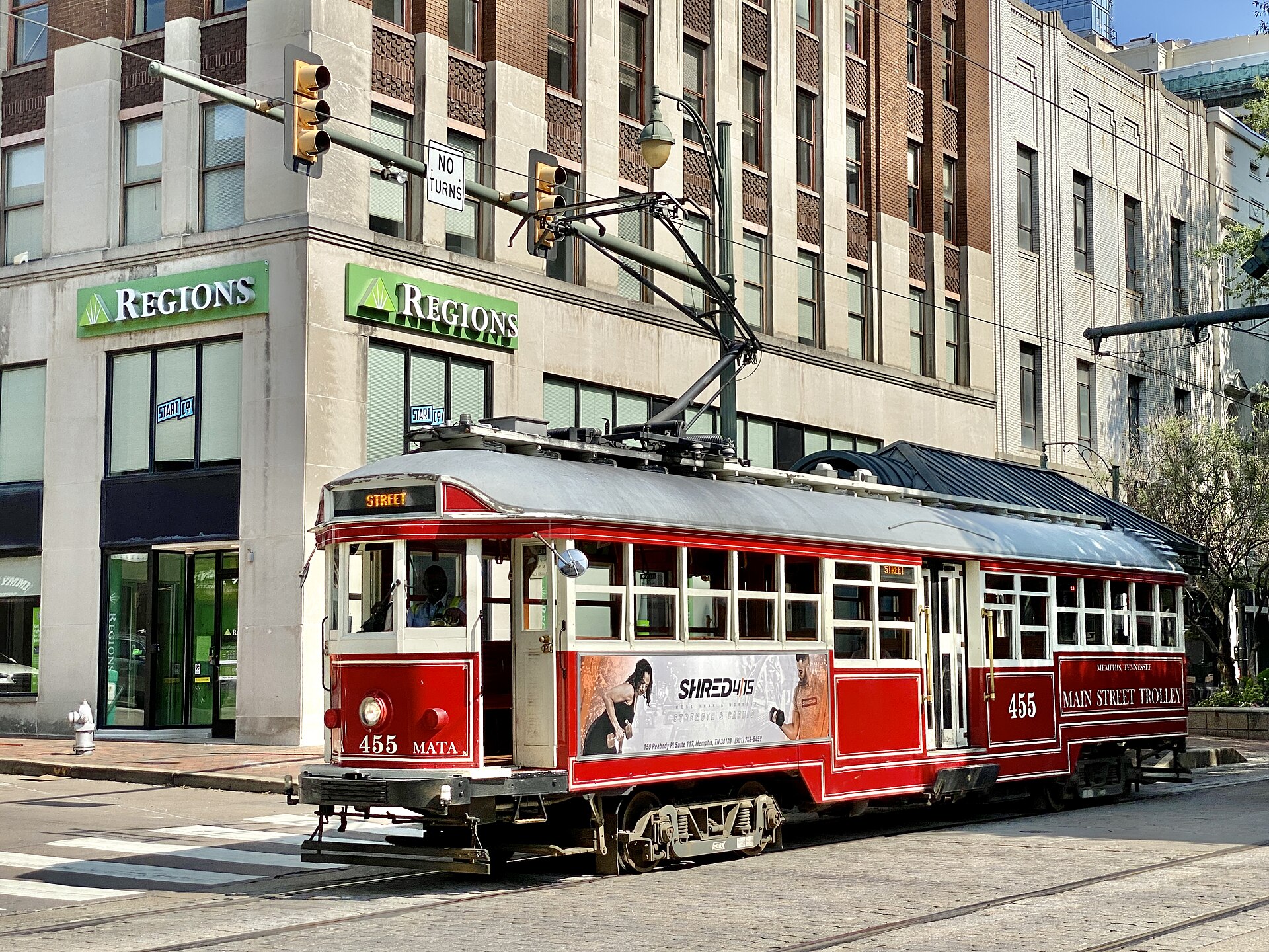
The Main Street Trolley is a heritage rail line in Downtown Memphis, operated by the Memphis Area Transit Authority (MATA). Vintage and replica streetcars run on fixed rail down Main Street, and on lines that have not always been fully staffed or running, along the riverfront and out Madison Avenue toward the Medical District. It is not a citywide system.
What is the Main Street Trolley, exactly?
It is a rail-based transit line built and operated by MATA, using cars styled after early-20th-century streetcars. MATA revived streetcar service in Downtown Memphis in 1993, decades after the city’s original streetcar network had been retired and its tracks paved over. The revived system was designed less as a commuter line and more as a fixed, visible spine connecting the length of Downtown on foot-friendly rails.
Where do the trolley lines actually run?
Historically there have been three distinct lines, and they do not all go to the same places. Understanding the difference matters more than the word “trolley” suggests.
- Main Street Line: runs the length of Main Street through the Downtown core, from the northern end near the Pinch District down past AutoZone Park, across Beale Street, and into South Main and the Arts District, ending near Central Station.
- Riverfront Loop: extends off Main Street onto Riverside Drive and Front Street, tracing the bluff above the Mississippi past the area near the Memphis Pyramid.
- Madison Avenue Line: runs east from Main Street along Madison Avenue toward the Medical District.
All three lines begin and end inside Downtown Memphis‘s boundaries. None of them reach Midtown, East Memphis or any residential neighborhood outside the Downtown-to-Medical District corridor.
Why did service stop, and is the whole system running today?
The system was suspended after a series of fires involving the vintage cars. A trolley fire on Main Street in 2013 was followed by another in 2014, and MATA pulled the entire fleet off the tracks that year pending a full safety review of the cars’ wiring and mechanical systems.
The Main Street Line reopened in 2018 after MATA rebuilt and re-certified a portion of the fleet. The Riverfront Loop and Madison Avenue Line have had a slower and less consistent path back into service, and their operating status has changed more than once since. This is precisely the kind of detail that goes stale fast: confirm current line status, hours and any service gaps directly on MATA’s own site before planning around the trolley rather than a bus or a car.
What are the actual vehicles, and why do some look older than others?
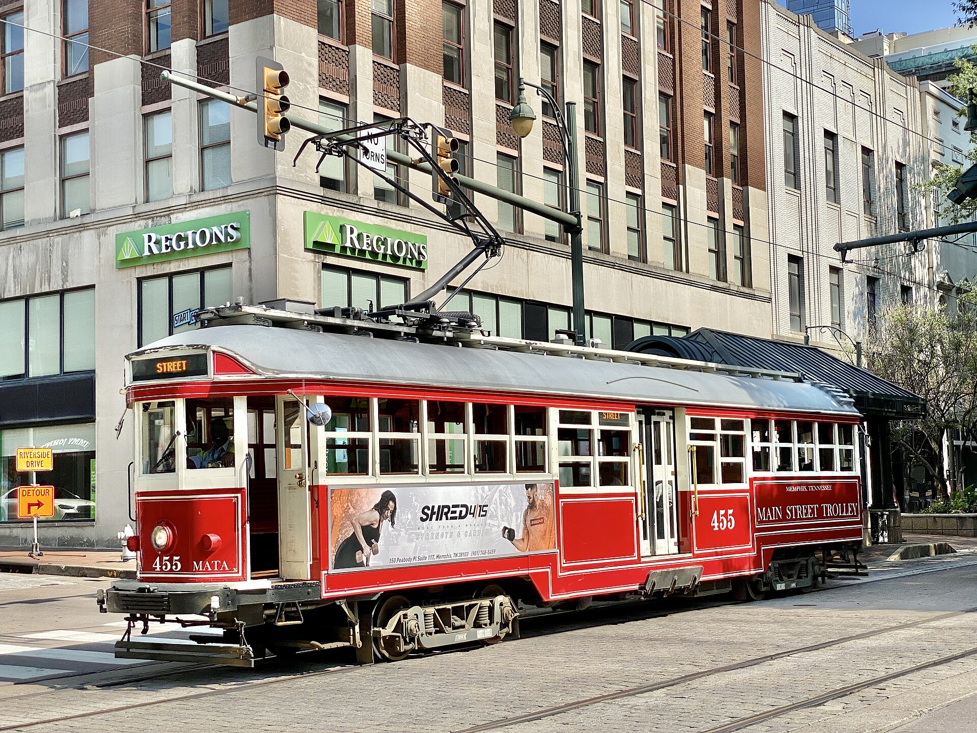
The fleet is a mix. Some cars are vintage streetcars acquired from other transit systems and restored for use in Memphis; MATA’s own fleet history describes cars originally built for service abroad, including examples associated with Australian and Portuguese transit operations, alongside newer replica cars built in the same early-20th-century body style specifically for the Memphis line. The visual effect is a single-looking fleet with genuinely different histories underneath the paint.
.jpg)
How does the fare work?
The trolley is priced and paid for as part of MATA’s regular fare structure, not as a separate tourist ticket. Riders typically pay onboard, and MATA’s system supports both cash fares and its own fare card or app for regular use. Fares, transfer rules and any day-pass options change periodically, so treat any specific figure as provisional and check MATA’s current fare page rather than relying on a printed number here.
For a resident using MATA across a year rather than a single ride, the trolley fare sits inside the same fare system as the city’s bus network — worth understanding through MATA’s own site if the trolley is part of a regular commute rather than an occasional Downtown ride.
Is the trolley useful for getting around, or is it a novelty?
It depends on where a rider is going. For moving along Main Street itself — between Central Station, the South Main Arts District, the AutoZone Park area and the northern edge of Downtown near Beale Street — the trolley covers ground that is otherwise a genuinely long, flat walk. For anything off that single corridor, it is not the tool for the job.
Downtown Memphis is compact enough that many visitors and residents simply walk it, and the trolley’s limited frequency and single-line geography mean it supplements walking rather than replacing a car for anything beyond Downtown. The broader question of whether a car is necessary at all in Memphis is covered directly in Do You Need a Car in Memphis? An Honest Answer, which weighs the trolley against MATA’s bus network and rideshare.
Does it connect to anything outside Downtown?
No. The Main Street Trolley’s three lines are entirely contained within Downtown and its immediate edge toward the Medical District. It does not reach Midtown, Cooper-Young, Overton Square, East Memphis or any of the neighborhoods that make up the wider city. MATA’s bus network, not the trolley, is the system that actually spans Memphis, and it is covered in more detail in the site’s Getting Around section.
That distinction matters for anyone reading this from a resident’s chair rather than a visitor’s. The trolley is a Downtown fixture — a visible, photogenic piece of the streetscape near Beale Street and the riverfront — but it is not infrastructure most Memphians use to get to work, school or the grocery store. For a wider picture of how Downtown fits against the rest of the city and its neighborhoods, the Living in Memphis hub and the Neighborhoods archive both go further than a single transit line can.
What should a first-time rider actually expect?
A rider should expect a slow, at-grade ride on shared street track, stopping frequently, moving at roughly the pace of the traffic around it rather than faster. It is not a subway substitute and was never built to be one. It runs on a fixed schedule set by MATA, and like any single-line system, a missed car simply means waiting for the next one rather than rerouting.
For visitors staying near Beale Street or in the South Main Arts District, the practical use case is short hops along Main Street rather than a full Downtown itinerary. The broader planning questions — what else sits within walking distance, what belongs on a Downtown day, how the riverfront and Main Street corridor fit together — are covered in the Memphis Practical hub, which is the better starting point than treating the trolley as a sightseeing tour in itself.
Access Memphis is an independent guide written from published, checkable sources. We have not visited the places described here and we do not publish personal recommendations or invented ‘local favourites’ — where something is singled out as notable, we say who says so. Opening times, fares, closures and prices change at short notice, so treat everything here as a starting point and confirm with the museum, operator or venue directly before building a day around it. We give no advice on visas, insurance, health or safety; use your own government’s official guidance for those.
Featured image: Photo by Warren LeMay from Chicago, IL, United States, source, CC BY-SA 2.0
.jpg)